Overview
On 30 March 2026, the NSW Environment Protection Authority launched the state’s first dedicated statewide PFAS ambient monitoring programme. Working in collaboration with DCCEEW Science and DPIRD Fisheries, the EPA has commenced collecting water, sediment, and biota samples, including fish tissue, across more than 200 sites spanning 17 catchment areas. The programme covers major catchments including the Hunter, Hawkesbury, Murrumbidgee, and Snowy rivers, representing one of the most geographically comprehensive environmental PFAS monitoring efforts undertaken in Australia to date.
The significance of this programme extends well beyond routine monitoring. For contaminated land practitioners, risk assessors, developers, and legal advisers operating in New South Wales, the absence of reliable, defensible ambient PFAS concentration data has long been a complicating factor in site assessments and remediation negotiations. When investigations detect low-level PFAS impacts at a site, it is frequently unclear whether those concentrations reflect historical on-site activity, diffuse catchment contamination, or a combination of both. Without a regional baseline, practitioners have been forced to rely on conservative default values or argue the point without empirical support, which can delay development approvals and inflate remediation scopes unnecessarily.
The programme is structured in strict alignment with the PFAS National Environmental Management Plan 3.0, published in March 2025, which is the current governing framework for PFAS investigation and management in Australia. By anchoring the monitoring methodology directly to the NEMP 3.0 framework, the NSW EPA is reinforcing the plan’s practical application and signalling that the resulting dataset will be directly usable within the regulatory assessment process. The EPA has explicitly stated that the data collected will inform future policies and management programmes, which has direct implications for how practitioners approach site assessments, discharge agreements, and remediation target negotiations.
Key details of the NSW EPA PFAS statewide ambient monitoring programme
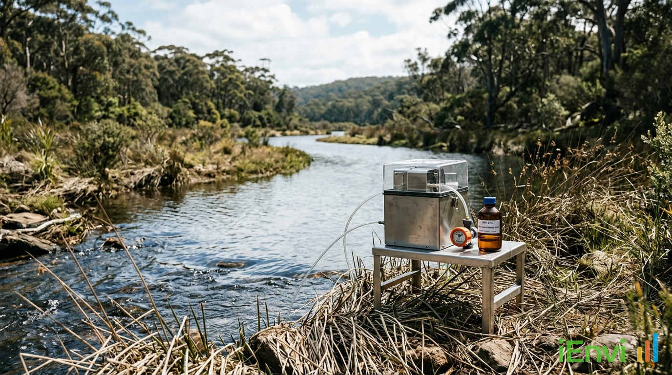
The programme involves the collection of three sample matrices across each monitoring location: surface water, sediment, and biota in the form of fish tissue. Sampling across all three matrices is important because PFAS compounds partition differently across environmental compartments. Hydrophilic shorter-chain PFAS compounds tend to remain in the water column, while longer-chain compounds such as PFOS and PFOA have a greater tendency to bind to sediment organic matter and bioaccumulate in fish tissue. Capturing all three matrices simultaneously provides a far more complete picture of environmental loading than water sampling alone.
To capture genuine ambient conditions free from the influence of point sources, the EPA has established a minimum buffer distance of two kilometres from any known PFAS source, with most sites located five kilometres or more away. This requirement is itself a striking indicator of how pervasive PFAS contamination has become across the modern landscape. The fact that regulators need to travel up to five kilometres from a known source to find conditions that can reasonably be called background highlights the cumulative footprint of decades of PFAS use in firefighting foams, industrial processes, and consumer products. It also highlights why a formal, empirically grounded ambient dataset is so necessary: informal assumptions about background levels are no longer tenable.
The 200-plus sampling sites are distributed across 17 catchment areas and have been selected to cover all five land-use categories outlined in the PFAS NEMP 3.0. Those categories span urban environments, agricultural land, remote or natural areas, freshwater systems, and estuarine and marine environments. Stratifying the dataset across these categories is methodologically significant. It means the resulting data will not be a single state-wide average that obscures variation between land uses. Instead, practitioners will be able to draw on category-specific ambient values that are directly comparable to the land-use classifications used during NEMP 3.0 site assessments. This alignment between monitoring design and regulatory framework is deliberate and ensures the data will be actionable rather than merely informative.
The three agency collaboration structure, involving the NSW EPA, DCCEEW Science, and DPIRD Fisheries, reflects the cross-jurisdictional nature of PFAS as an environmental issue. DPIRD Fisheries brings specialist expertise in fish biology and tissue sampling methodology, which is critical for generating biota data that meets analytical quality objectives. DCCEEW Science contributes environmental chemistry and data management capacity. This multi-agency design reduces the risk of methodological inconsistency across the 17 catchments and should produce a dataset of sufficient rigour to withstand scrutiny in regulatory and legal proceedings.

Australian regulatory context: PFAS NEMP 3.0 and national PFAS management frameworks
The PFAS National Environmental Management Plan 3.0, published in March 2025, is the current standard governing PFAS investigation, risk assessment, and management across Australian jurisdictions. NEMP 3.0 superseded the previous version and introduced updated guideline values, revised land-use categories, and refined methodology for site characterisation. Critically, NEMP 3.0 distinguishes between site-specific contamination and ambient or background concentrations, and it provides a framework for how practitioners should treat background in their risk assessments. However, until now, the empirical data needed to apply that framework with confidence in New South Wales has not existed in a systematic, publicly available form. The NSW EPA programme directly addresses this gap, providing the state with a structured, publicly available ambient dataset that aligns with the NEMP 3.0 assessment methodology.
Background and context
NSW EPA Launches State's First Dedicated Statewide PFAS Ambient Monitoring Program
On 30 March 2026, the NSW Environment Protection Authority (EPA) launched the state’s first dedicated statewide PFAS ambient monitoring program. In collaboration with DCCEEW Science and DPIRD Fisheries, the EPA has commenced collecting water, sediment, and biota (fish) samples across more than 200 sites in 17 catchment areas (including the Hunter, Hawkesbury, Murrumbidgee, and Snowy rivers).
Crucially, the sampling methodology has been designed in strict alignment with the newly published PFAS NEMP 3.0. To capture true ambient (background) conditions, all sample sites are located at least two kilometres—and mostly five kilometres—away from any known PFAS sources. Sampling will cover all five land-use categories outlined in the NEMP 3.0, spanning urban, agricultural, remote, and marine environments.
Why it Matters for Environmental Professionals:
Establishing an accurate baseline for ambient PFAS concentrations is a massive development for contaminated land practitioners and risk assessors.
To find "true background" levels free from direct point-source influence, the EPA has had to establish a minimum buffer of 2 to 5 kilometres away from any known PFAS source—highlighting just how pervasive these compounds are in the modern landscape.
References and related sources
- Primary source: www.epa.nsw.gov.au
- https://www.epa.nsw.gov.au/your-environment/pfas-in-nsw/statewide-pfas-ambient-m
- PFAS National Environmental Management Plan (NEMP)
- NSW EPA
How iEnvi can help
iEnvi provides specialist consulting services relevant to this topic. Our team includes CEnvP Site Contamination Specialists with experience across contaminated land, groundwater, remediation, ecology, and regulatory compliance.
- iEnvi contaminated land services
- iEnvi remediation services
- iEnvi expert services and independent review services
This is an iEnvi Machete news summary. Prepared by iEnvi to summarise the source article for contaminated land, groundwater, remediation, approvals and site risk professionals.
Published: 04 Apr 2026
Need advice on this topic? Speak to an iEnvi expert at info@ienvi.com.au or 1300 043 684, or contact us online.
Need advice on this issue? iEnvi provides practical, senior-led environmental consulting across contaminated land, remediation, ecology and environmental risk.
Team credentials Environmental management plans Contaminated land advice Remediation services Talk to iEnvi