
Overview
The NSW Government released its latest Statewide Land Cover and Tree Study (SLATS) monitoring data in July 2025, revealing a 16% overall increase in native vegetation clearing across New South Wales between 2023 and 2024. The data, compiled using high-resolution satellite imagery analysed over a 20-year continuous monitoring period, shows total vegetation clearing for 2024 reached approximately 81,293 hectares when woody and non-woody categories are combined. For environmental practitioners, property developers, legal advisers, and local councils operating in NSW, the findings carry immediate regulatory consequences and signal a period of heightened enforcement activity and legislative reform.
The result most likely to attract regulatory scrutiny is the attribution gap embedded in the data. Sixty per cent of all vegetation clearing recorded in 2024 could not be matched to any identified regulatory authorisation or exemption under the existing framework. That is a figure that should concern every environmental adviser involved in pre-acquisition due diligence, development assessment, or rural land transactions across the state. Whether the gap reflects genuine non-compliance or deficiencies in how exemptions are tracked and data-matched within the SLATS system, the NSW Government has been explicit in flagging this attribution issue as a primary driver of its proposed reforms under the NSW Plan for Nature.
The NSW Plan for Nature represents the government’s formal reform agenda responding to independent reviews of both the Biodiversity Conservation Act 2016 (NSW) and the Local Land Services Act 2013 (NSW). The 20-year SLATS dataset is being used as the evidentiary foundation for accelerating these reforms. Conservation groups have publicly described the clearing rates as unacceptable, and the political and regulatory trajectory strongly suggests that conditions for landholders, developers, and infrastructure proponents will tighten materially in the near term.
Key details
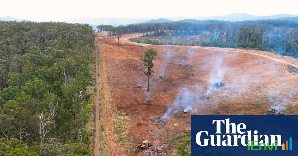
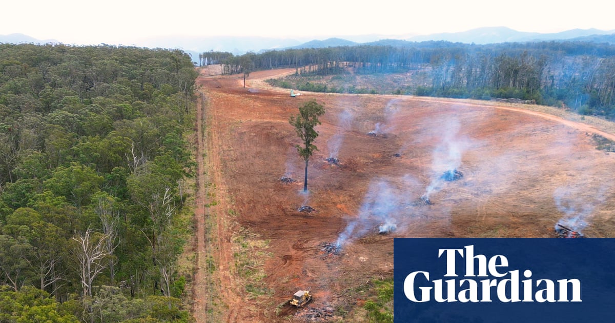
The 2024 SLATS data separates vegetation clearing into two primary categories: woody vegetation and non-woody vegetation. Woody vegetation clearing, which covers forest, woodland, and scrubland, reached 24,103 hectares in 2024, representing a slight decline compared to the previous reporting period. However, this figure still equates to approximately 66 hectares per day, or roughly 89 AFL-sized football fields of forest and woodland cleared each day when contextualised by the Guardian’s reporting on the dataset. Non-woody vegetation clearing, which covers grasslands, ground cover, and wetland fringe vegetation, surged to 57,190 hectares in 2024, up from 33,651 hectares in the prior year. That increase in non-woody clearing of approximately 23,539 hectares year-on-year is a 70% jump in that category alone and accounts for the bulk of the 16% overall increase.
The attribution analysis within the SLATS framework attempts to cross-reference detected clearing events against recorded authorisations, self-assessable codes, and exemptions under Part 5A of the Local Land Services Act 2013 and the Biodiversity Conservation Act 2016. In 2024, 60% of detected clearing events were classified as “unallocated,” meaning no corresponding regulatory record could be identified. This attribution failure is significant for two reasons. First, it may indicate that a substantial volume of clearing is occurring without any legal basis, which would constitute non-compliance under both pieces of legislation. Second, it may indicate that the exemption notification and recording systems are not capturing clearing that is in fact lawfully authorised, which would point to systemic administrative gaps that the reforms will need to address. The NSW Department of Climate Change, Energy, the Environment and Water has confirmed that both possibilities are being investigated.
The SLATS programme has operated continuously for 20 years, using Landsat and higher-resolution satellite imagery to detect changes in vegetation extent and cover across all land tenures in NSW. Detection capability has improved substantially over that period, with current systems capable of identifying clearing events at scales relevant to individual paddocks and small lots. The spatial accuracy and temporal resolution of current satellite monitoring means that clearing activities that would previously have gone undetected for months can now be flagged rapidly, in some cases in near real-time. This technical capability underpins the government’s enforcement posture and explains why practitioners should treat any assumption of detection delay as unreliable.
On the conservation side, the same dataset records a genuinely positive trend. Since 2018, more than 500,000 hectares of private land in NSW have been secured under Local Land Services set-asides or in-perpetuity conservation agreements. This represents a meaningful accumulation of privately conserved land and establishes a growing base from which environmental market instruments, including biodiversity credits and carbon sequestration arrangements, can be structured. The Biodiversity Conservation Trust administers a number of these agreements, and their existence signals that private landholders are engaging with conservation as a land management option where the regulatory and economic conditions support it.
Australian context: implications for NSW biodiversity regulation and land assessment practice
The regulatory framework governing native vegetation clearing in NSW sits across two principal statutes. The Biodiversity Conservation Act 2016 applies to land that triggers the biodiversity assessment requirements attached to development applications under the Environmental Planning and Assessment Act 1979, and to clearing that requires a biodiversity development assessment report or offsets payment. Part 5A of the Local Land Services Act 2013 governs clearing on rural land outside the development assessment pathway.
References and related sources
- Primary source: www.theguardian.com
- nsw.gov.au
- nationaltribune.com.au
- spatialsource.com.au
- nsw.gov.au
- NEPM Assessment of Site Contamination
- EPBC Act
How iEnvi can help
iEnvi provides specialist consulting services relevant to this topic. Our team includes CEnvP Site Contamination Specialists with experience across contaminated land, groundwater, remediation, ecology, and regulatory compliance.
- iEnvi due diligence services
- iEnvi remediation and validation services
- iEnvi expert services and independent review services
This is an iEnvi Machete news summary. Prepared by iEnvi to summarise the source article for contaminated land, groundwater, remediation, approvals and site risk professionals.
Published: 27 Jul 2026
Need advice on this topic? Speak to an iEnvi expert at info@ienvi.com.au or 1300 043 684, or contact us online.
Need advice on this issue? iEnvi provides practical, senior-led environmental consulting across contaminated land, remediation, ecology and environmental risk.
Team credentials Contaminated land services Remediation services Groundwater services Talk to iEnvi