
WA Mining Tenement Stop Work Order Overview
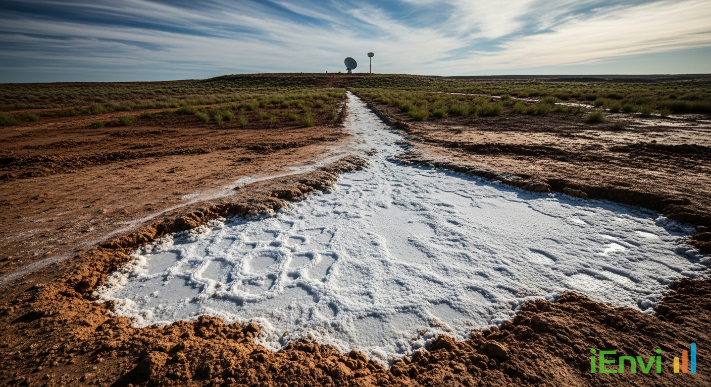
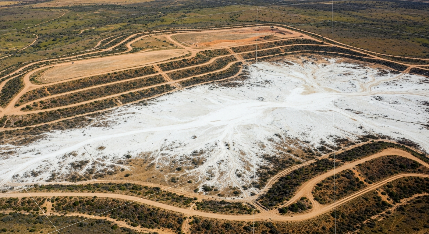
On 28 July 2026, inspectors from the Western Australian Department of Energy, Mines, Industry Regulation and Safety (DEMIRS) issued an immediate Stop Work Order against a mining tenement holder operating in the Phillips River region after discovering unauthorised discharge of highly saline groundwater directly into native vegetation. The discharge affected 23 hectares of land, causing measurable dieback of native vegetation both within and outside the project’s approved disturbance envelope. Critically, the saline water inundated topsoil stockpiles that had been specifically designated for future site rehabilitation, compromising one of the most fundamental resources required for successful mine closure and ecological restoration.
What makes this enforcement action particularly significant is not the discharge itself, but the evidentiary methodology regulators used to establish its timeline. DEMIRS environmental officers applied satellite imagery combined with Normalised Difference Moisture Index (NDMI) data to reconstruct the history of the discharge, determining retroactively that the unauthorised activity had commenced approximately two months before the physical inspection took place. This means the tenement holder’s non-compliance was quantified and dated without any tip-off, whistleblower report, or on-site audit during the period of the discharge itself. The regulator simply applied earth observation analysis after the fact and built an evidentiary record from orbital data.
For environmental professionals advising mining clients, developers, and tenement holders across Australia, this case marks a meaningful shift in how environmental enforcement works in practice. The assumption that non-compliance during the gap between physical inspections carries lower detection risk is now demonstrably false. Australian regulators are integrating remote sensing tools into their compliance frameworks, and this Western Australian case is among the clearest public examples of satellite-derived evidence being used to ground a formal Stop Work Order under the Mining Act 1978 (WA).
Key details of the Phillips River Stop Work Order and NDMI-based enforcement
The tenement holder admitted openly that the decision to discharge saline groundwater was deliberate and operationally motivated. The operator lacked sufficient on-site capacity to store the excess groundwater volumes being generated by mining activities and chose to discharge that water unilaterally rather than halt production or seek regulatory guidance. Under the Mining Act 1978 (WA) and the Mining Regulations 1981 (WA), this reasoning carries no legal weight as a defence. Operational necessity does not constitute grounds for bypassing tenement environmental conditions, and the immediate Stop Work Order reflects that position without ambiguity.
The 23-hectare impact area spanned land both inside and outside the project’s approved disturbance envelope. The approved disturbance envelope is a formally defined boundary within which a tenement holder is permitted to disturb land as part of their operations. Any impact outside that boundary constitutes a breach of tenement conditions regardless of whether the activity causing that impact originates from within the approved area. In this case, the saline plume migrated beyond the envelope boundary and affected native vegetation that was never subject to any disturbance approval, compounding the legal exposure for the operator significantly.
The technical consequences of saline inundation on topsoil stockpiles are severe and, in some circumstances, irreversible within practical timeframes. High salinity disrupts soil osmotic balance, kills soil microbial communities including mycorrhizal fungi critical to plant establishment, and degrades soil aggregate structure. Rehabilitating disturbed mine land without a viable topsoil resource requires either importation of replacement material at considerable cost or reliance on subsoil and overburden that will typically produce far inferior revegetation outcomes. Where a mine closure plan or rehabilitation management plan specifies topsoil as the growth medium for revegetation, loss or contamination of that stockpile directly threatens compliance with closure milestones and the conditions under which environmental bonds or financial assurances are held by the regulator.
NDMI, or the Normalised Difference Moisture Index, is a satellite-derived spectral index calculated from near-infrared and short-wave infrared reflectance bands. It is sensitive to changes in vegetation water content and soil moisture conditions, making it well-suited to detecting anomalous wet or waterlogged conditions in otherwise dry or semi-arid landscapes. By analysing a time series of NDMI raster data from freely available or commercially licensed satellite platforms, DEMIRS was able to identify when the moisture anomaly first appeared in the Phillips River area and track its spatial extent over time. This approach allowed regulators to establish a two-month historical record of the discharge with sufficient specificity to support a formal enforcement action, without having had any officer physically present on the site during that period.
Australian context: satellite surveillance, mine closure obligations and groundwater management frameworks
The use of NDMI-based satellite analysis by DEMIRS reflects a broader trend in Australian environmental regulation toward remote sensing as a routine compliance tool. The Australian Government’s Geoscience Australia maintains substantial earth observation infrastructure and data archives, and state environmental and resources agencies have progressively integrated satellite-derived datasets into monitoring workflows. In the context of mining regulation, this capability is particularly relevant because mine sites are often remote, large in area, and difficult to inspect frequently through conventional ground-based methods alone.
References and related sources
- Primary source: www.wa.gov.au
- NEPM Assessment of Site Contamination
How iEnvi can help
iEnvi provides specialist consulting services relevant to this topic. Our team includes CEnvP Site Contamination Specialists with experience across contaminated land, groundwater, remediation, ecology, and regulatory compliance.
- iEnvi groundwater services
- iEnvi remediation and validation services
- iEnvi expert services and independent review services
This is an iEnvi Machete news summary. Prepared by iEnvi to summarise the source article for contaminated land, groundwater, remediation, approvals and site risk professionals.
Published: 29 Jul 2026
Need advice on this topic? Speak to an iEnvi expert at info@ienvi.com.au or 1300 043 684, or contact us online.
Need advice on this issue? iEnvi provides practical, senior-led environmental consulting across contaminated land, remediation, ecology and environmental risk.
Team credentials Contaminated land services Remediation services Groundwater services Talk to iEnvi