New Reef Mapping Data for Northern Australia
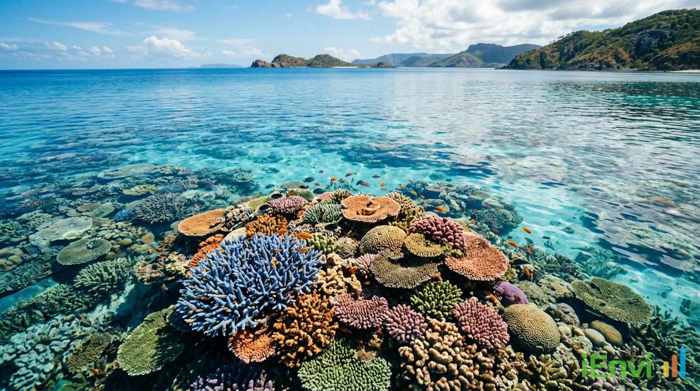
Researchers from the Australian Institute of Marine Science (AIMS) and the University of Queensland have completed a landmark reef mapping project that adds more than 1,000 previously uncharted coral reefs to the documented marine environment of northern Australia. Published in April 2026 and funded through the National Environmental Science Program (NESP), the project classified boundaries for over 3,600 coral reefs and approximately 2,900 rocky reefs, spanning a vast coastal arc from the Houtman Abrolhos Islands in Western Australia through to western Cape York in Queensland. The findings redraw the ecological baseline for one of Australia’s most ecologically significant and least-studied marine regions.
These reefs were not simply poorly described in existing datasets. They were functionally invisible to standard mapping approaches because they sit beneath the sediment-rich, turbid waters characteristic of northern Australia’s inshore coastal zone. Historical marine charts for these areas recorded navigational hazards but made no distinction between rocky substrates and living coral reef ecosystems. That distinction matters enormously when it comes to environmental law, habitat offset calculations, and the obligations of project proponents under Commonwealth and state regulatory frameworks.
For environmental planners, marine ecologists, and consultants supporting coastal development approvals, port expansions, dredging programmes, and offshore energy projects, this dataset represents a significant update to available data. The high-resolution spatial data is now publicly available through eAtlas and the Australian Ocean Data Network (AODN), meaning there is no reasonable basis for a project proponent to claim ignorance of its existence. Regulators will be entitled to expect that any desktop habitat assessment conducted from this point forward incorporates this newly available baseline.
Implications of New Northern Australian Reef Mapping Data for Environmental Approvals
The NESP-funded mapping project ultimately classified boundaries for 3,600 coral reefs and 2,900 rocky reefs across northern Australia. Of those coral reefs, more than 1,000 had no prior formal documentation in any publicly accessible dataset. The geographic coverage is substantial, stretching from the Houtman Abrolhos Islands at approximately 28 degrees south latitude in Western Australia, eastward through the Kimberley, across the Gulf of Carpentaria, and up to the western tip of Cape York Peninsula in Queensland. The AIMS research team noted that the reef density across this region is comparable in quantity to the Great Barrier Reef, though the individual reef structures tend to be smaller in area.
The methodological challenge that defined this project was the failure of automated mapping techniques in turbid water conditions. Automated classification tools, which rely on spectral analysis of satellite or aerial imagery to identify benthic habitat types, produced an unacceptably high rate of false positives across the murky inshore waters of northern Australia. Suspended sediment loads in these environments scatter and absorb light in ways that confound standard spectral signatures used to distinguish coral from sand, rock, or seagrass. Rather than accept results of questionable accuracy, the research team abandoned automated methods entirely and committed to manual digitisation. That process required 700 hours of skilled analyst time to achieve the spatial precision necessary for regulatory-grade habitat mapping.
The outputs are now accessible as high-resolution spatial datasets through two publicly available platforms: eAtlas, which is maintained by AIMS and provides an interactive mapping interface, and the Australian Ocean Data Network (AODN), which serves as Australia’s primary repository for marine and climate science data. Both platforms allow users to download or query the data in formats compatible with standard GIS software. This accessibility is directly relevant to how regulators and project proponents are expected to engage with the dataset going forward.
One of the more ecologically significant findings is the characterisation of these reefs as genuinely distinct habitat types rather than simply extensions of the rocky substrate category. Coral reef ecosystems in turbid, high-nutrient inshore waters support different assemblage structures compared to clear-water offshore reefs. They may serve critical functions as nursery habitats, feeding grounds, and refugia that are not replicated elsewhere in the marine environment. The prior absence of these reefs from formal datasets meant that no regulatory weight was attached to them, regardless of their ecological function. That situation has now changed.

Australian regulatory context: EPBC Act referrals, marine spatial planning, and the new habitat baseline
Under the Environment Protection and Biodiversity Conservation Act 1999 (EPBC Act), project proponents are required to assess whether a proposed action is likely to have a significant impact on a matter of national environmental significance. Marine and coastal waters adjacent to Commonwealth marine areas, as well as listed marine species and habitats, fall squarely within that framework. Coral reef ecosystems in Australian waters have long been recognised as sensitive habitats capable of triggering EPBC Act referral obligations, but the absence of these reefs from available datasets meant they could not be meaningfully incorporated into referral documentation or environmental impact assessments. With the AIMS dataset now publicly available, that gap no longer exists as a defensible excuse.
The practical threshold question for EPBC Act purposes is whether a proposed action is likely to have a s
References and related sources
- Primary source: www.aims.gov.au
- EPBC Act
How iEnvi can help
iEnvi provides specialist consulting services relevant to this topic. Our team includes CEnvP Site Contamination Specialists with experience across contaminated land, groundwater, remediation, ecology, and regulatory compliance.
- iEnvi contaminated land investigation services
- iEnvi remediation and validation services
- iEnvi expert services and independent review services
This is an iEnvi Machete news summary. Prepared by iEnvi to summarise the source article for contaminated land, groundwater, remediation, approvals and site risk professionals.
Published: 23 Apr 2026
Need advice on this topic? Speak to an iEnvi expert at hello@ienvi.com.au or 1300 043 684, or contact us online.
Need advice on this issue? iEnvi provides practical, senior-led environmental consulting across contaminated land, remediation, ecology and environmental risk.
Contaminated land services Remediation services Groundwater services Ecological assessment Talk to iEnvi