Overview
A peer-reviewed paper published on 2 May 2024 in Geoscientific Instrumentation, Methods and Data Systems by researchers from UNSW, Flinders University, and collaborating institutions details the establishment and initial data outputs of Australia’s National Groundwater Recharge Observing System (NGROS). The paper represents the first systematic, nationally coordinated attempt to directly measure deep drainage flux through the vadose zone at the event scale, replacing decades of reliance on broad volumetric recharge estimates derived from historical averages, chloride mass balance, or water table fluctuation methods. The NGROS network achieves this by deploying automated hydrological drip counters within existing underground infrastructure, including mine adits, road tunnels, and natural cave systems, at sites spanning multiple hydroclimatic zones across the Australian continent.
The practical significance of this work extends well beyond academic hydrogeology. Estimating groundwater recharge has long been acknowledged as one of the most uncertain and contested inputs in any Conceptual Site Model (CSM). That uncertainty cascades directly into contaminant transport models, risk assessments, and ultimately into remediation designs and regulatory decisions. By establishing physically measured, site-specific rainfall recharge thresholds, NGROS provides practitioners with a fundamentally different class of data: not a statistical inference, but a direct physical observation of the moment water crosses from the unsaturated zone into the saturated aquifer. For developers, councils, environmental lawyers, and contaminated land consultants working across Australia’s diverse geology and climate, this is a material improvement in what is technically achievable.
The timing of this research coincides with increasing regulatory scrutiny of groundwater modelling quality in site assessments across Queensland, New South Wales, Victoria, and South Australia. Regulators and site auditors are applying progressively higher standards to the defensibility of CSMs, particularly on sites where groundwater plume migration presents off-site risk. The NGROS data set represents a new benchmark against which the adequacy of recharge estimation methods in existing and future assessments will increasingly be measured.
Key Details of the NGROS Network Methodology and Findings
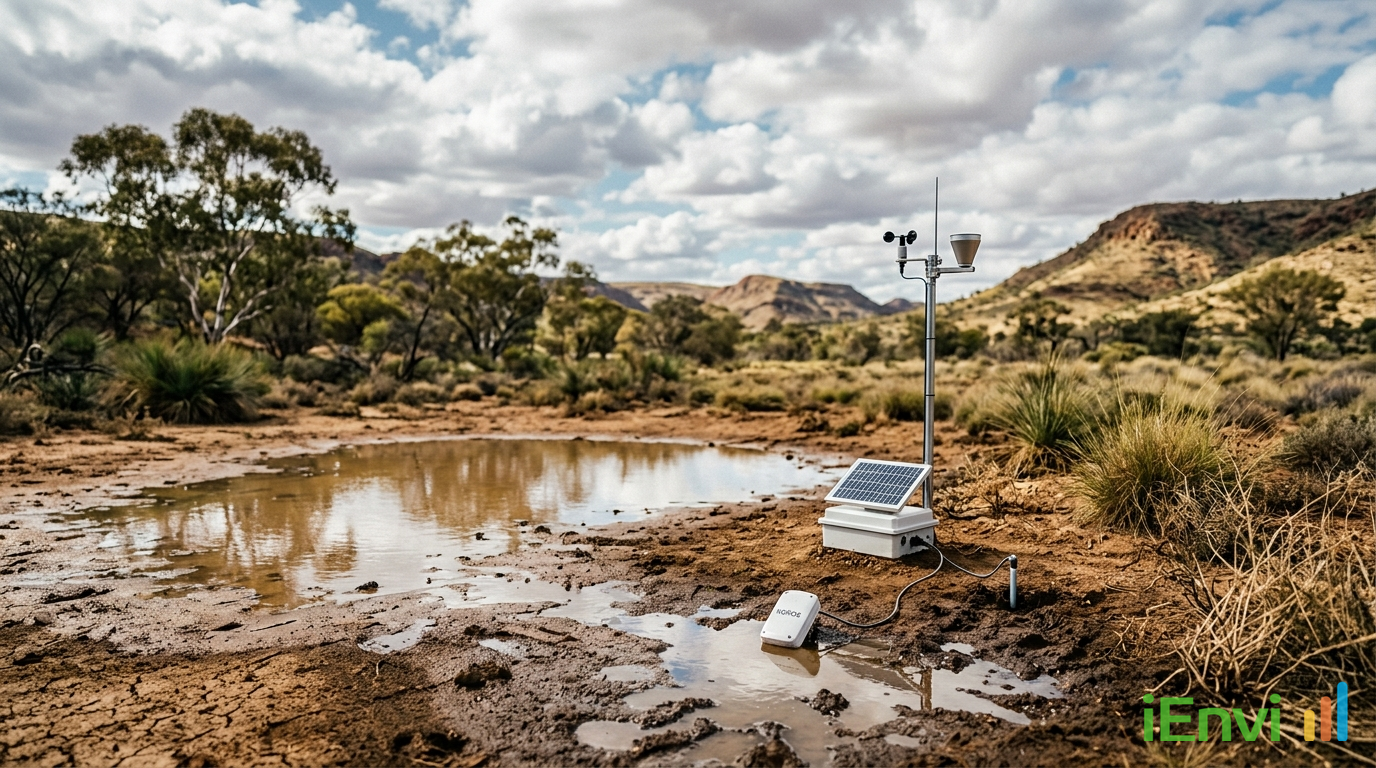
The NGROS network operates by instrumenting the void spaces that naturally occur below the base of the vadose zone in underground infrastructure. Automated drip counters, also described as hydrological loggers, are installed at points where water percolating through unsaturated soils and rock emerges as discrete drips or flows. Each drip event is timestamped, providing a continuous, high-resolution record of deep drainage flux. When this record is compared against co-located or nearby daily rainfall data, researchers can identify the precise cumulative or event-based rainfall amount that is required to initiate a measurable recharge response at depth. This threshold value is specific to the geology, soil type, vegetation cover, and antecedent soil moisture conditions at each site.
The network spans sites across a range of Australian hydroclimates, from humid coastal zones to semi-arid inland regions. This geographic distribution is deliberate and critical: recharge thresholds vary enormously across the continent. In high-rainfall coastal environments with shallow, permeable soils, relatively modest rainfall events can trigger rapid recharge. In low-rainfall inland settings with deep clay-dominated profiles or thick calcrete horizons, recharge may only occur following exceptional multi-day rainfall sequences that overcome very high antecedent soil moisture deficits. The NGROS data allows these thresholds to be quantified physically rather than estimated from modelled water balance approaches, which have well-documented limitations in arid and semi-arid zones. The paper documents specific threshold measurements across monitored sites, with the network designed to grow as additional instrumented underground access points are incorporated.
A key methodological advantage of the NGROS approach is that utilising existing infrastructure, rather than purpose-built experimental bores or lysimeters, forms the backbone of the monitoring network. Mine adits, road and rail tunnels, and cave systems provide ready access to the base of the vadose zone at minimal additional cost. This approach means the network can be expanded geographically without prohibitive capital expenditure, and the underground environments provide shelter for sensitive logging equipment. The drip counters themselves are low-power, automated instruments capable of recording events at sub-daily resolution, generating time series that can be analysed for seasonal patterns, inter-annual variability, and the response to individual rainfall events. The paper notes that this event-scale resolution is what distinguishes NGROS outputs from prior national-scale recharge estimates, which typically reported annual or decadal averages with wide uncertainty bounds.
The shift from volumetric annual averages to event-based threshold measurements has direct technical consequences for groundwater modelling. Traditional recharge estimates used as inputs to numerical groundwater flow models, such as those constructed in MODFLOW or FEFLOW, carry large uncertainty ranges that propagate through velocity calculations and contaminant transport simulations. When recharge is uncertain by a factor of two or more, predicted plume migration rates and directions carry equivalent uncertainty. NGROS-derived threshold data allows modellers to parameterise recharge inputs using physically measured values tied to specific rainfall sequences, substantially tightening prediction intervals and improving the defensibility of modelled outcomes.


References and related sources
- Primary source: doi.org
How iEnvi can help
iEnvi provides specialist consulting services relevant to this topic. Our team includes CEnvP Site Contamination Specialists with experience across contaminated land, groundwater, remediation, ecology, and regulatory compliance.
- iEnvi contaminated land services
- iEnvi remediation services
- iEnvi expert services and independent review services
This is an iEnvi Machete news summary. Prepared by iEnvi to summarise the source article for contaminated land, groundwater, remediation, approvals and site risk professionals.
Published: 06 May 2026
Need advice on this topic? Speak to an iEnvi expert at info@ienvi.com.au or 1300 043 684, or contact us online.
Need advice on this issue? iEnvi provides practical, senior-led environmental consulting across contaminated land, remediation, ecology and environmental risk.
Contaminated land services Remediation services Groundwater services Ecology consulting Talk to iEnvi